
Full platform. No hardware required.
Real-time gps tracking. Zero hardware. One phone.
Turn everyday phones into fleet gps trackers. View your devices on a map with real-time locations and alerts.
- Live map locations, trips, and reports all in one dashboard.
- No signal, no credit — no problem. History fills in when you reconnect.
- Mileage and expenses.
- Speed alerts. You set the limit.
- Geo Zones. Know when devices enter or leave an area.
- Share live map. No login for customers.
- Low battery alerts. Never miss a job.
Live maps
Trinidad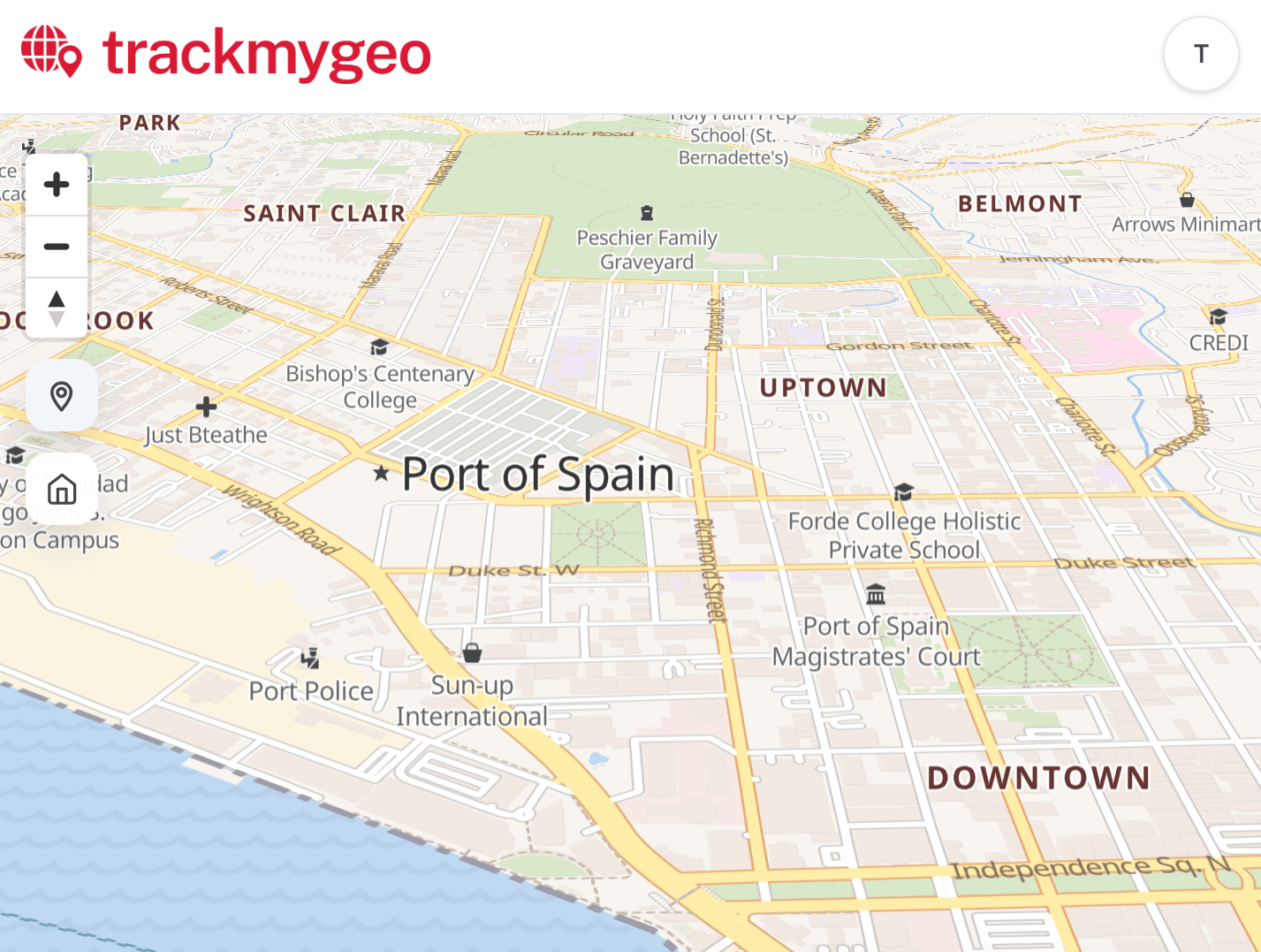
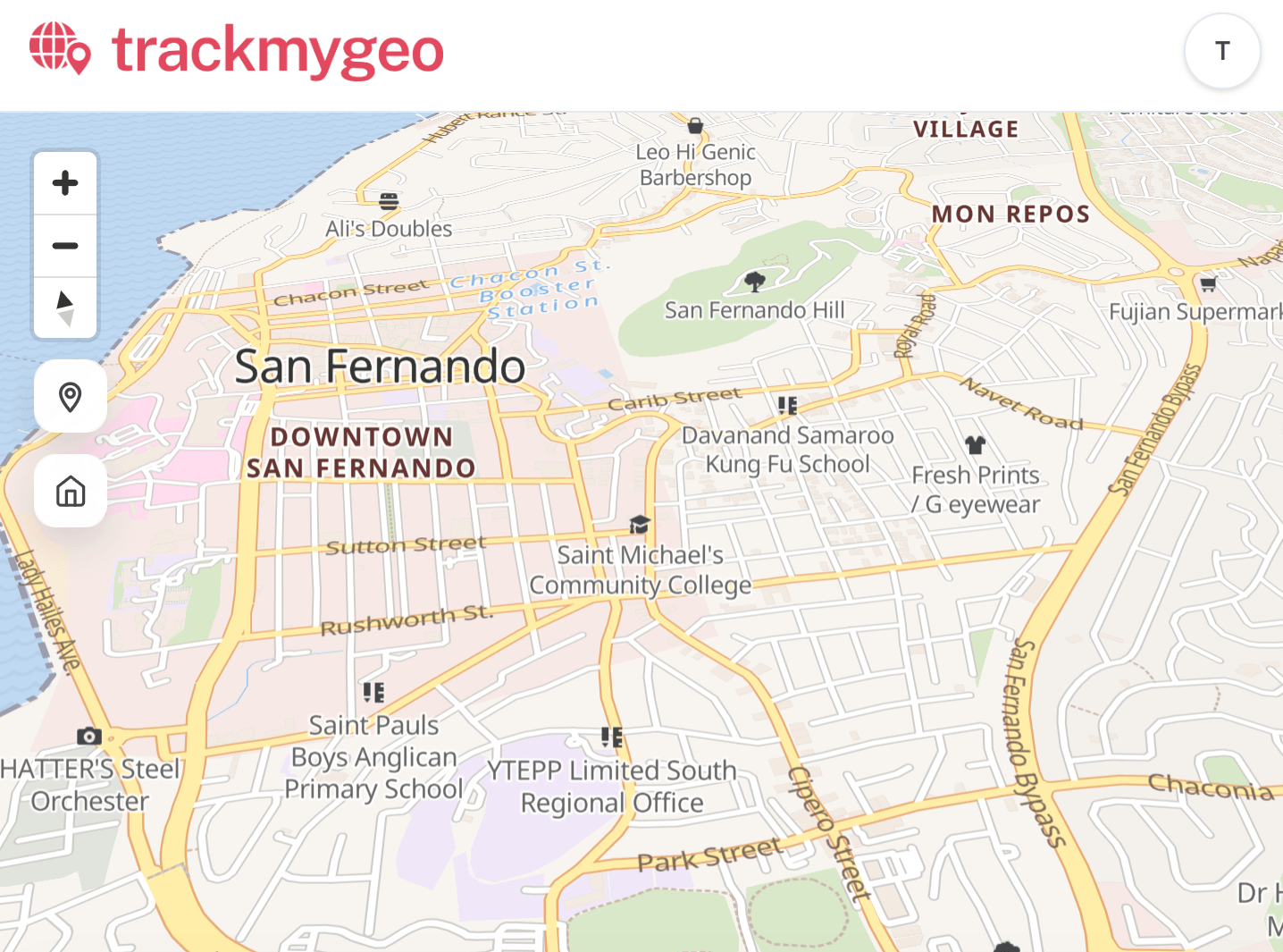
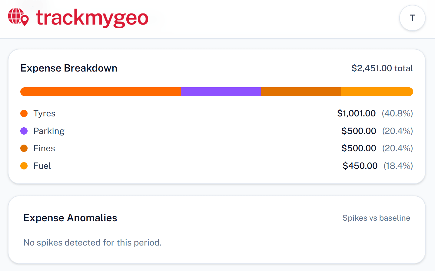
Actual screenshots
No hardware needed
Use the phones your team already carries. No GPS devices to buy, install, or maintain.
Instant visibility
See every device on a live map with real-time status, Geo Zones, and alerts.
No signal, no problem
Patchy coverage or empty credit doesn’t wipe the day. Locations queue on the phone and fill the map when you reconnect — mines, bush, ranches, rural sites.
Get speed alerts
Receive alerts when devices exceed set speed limits so you can promote safer driving and reduce risk.
Available in
Full vector map coverage across the Caribbean, the Americas, Africa, Europe, and Oceania.
 Algeria
 American Samoa
 Angola
 Argentina
 Australia
 Bangladesh
 Barbados
 Benin
Benin Bolivia
 Botswana
 Brazil
 British Indian Ocean Territory
 Burkina Faso
 Burundi
 Cameroon
 Canada
 Cape Verde
 Central African Republic
 Chad
Chad Chile
Chile Colombia
 Comoros
 Cook Islands
 Cuba
Cuba Democratic Republic of the Congo
 Djibouti
 Dominica
 Dominican Republic
 Ecuador
 Egypt
Egypt Equatorial Guinea
 Eritrea
 Eswatini
 Ethiopia
 Falkland Islands
 Fiji
Fiji French Guiana
 French Polynesia
 Gabon
Gabon Gambia
 Ghana
Ghana Grenada
 Guam
Guam Guinea
 Guinea-Bissau
 Guyana
 Haiti
Haiti Ireland
 Ivory Coast
 Jamaica
 Kenya
Kenya Kiribati
 Lesotho
 Liberia
 Libya
Libya Lithuania
 Madagascar
 Malawi
 Mali
Mali Marshall Islands
 Mauritania
 Mauritius
 Mayotte
 Mexico
 Micronesia
 Morocco
 Mozambique
 Namibia
 Nauru
Nauru New Caledonia
 New Zealand
 Niger
Niger Nigeria
 Niue
Niue Northern Mariana Islands
 Palau
Palau Papua New Guinea
 Paraguay
 Peru
Peru Republic of the Congo
 Réunion
 Rwanda
 Saint Helena, Ascension and Tristan da Cunha
 Saint Lucia
 Saint Vincent and the Grenadines
 Samoa
Samoa Sao Tome and Principe
 Senegal
 Seychelles
 Sierra Leone
 Solomon Islands
 Somalia
 South Africa
 South Sudan
 Sudan
Sudan Suriname
 Tanzania
 Togo
Togo Tokelau
 Tonga
Tonga Trinidad and Tobago
 Tunisia
 Tuvalu
 Uganda
 United Kingdom
 United States
 Uruguay
 Vanuatu
 Venezuela
 Wallis and Futuna
 Western Sahara
 Zambia
 Zimbabwe
113 countries and territories with dedicated or regional map tiles.
How TrackMyGeo works
From sign-up to phones on the map the same day.
Sign in and set up your account
Sign in with your email—we send a code, no password. Name your group, add each phone you want on the map, and invite helpers if you need them.
Connect each phone with a QR code—or a quick file
Each phone gets its own QR code in the portal: scan it with the camera and you’re linked in seconds—or send the setup file when someone’s not with you.
Map, areas, and past trips
See every phone on the map. Mark areas and get alerts. Look back at past trips when you need to.
Get started with TrackMyGeo
Launch with your first devices today and scale to a complete tracking workflow with alerts, reports, and optional public page sharing.
Frequently Asked Questions
Learn how Track my Geo can help different types of users and businesses.